
(February 2010) On Aug. 29, 2005, Hurricane Katrina made landfall as a Category 3 storm near the Louisiana-Mississippi border. Less than one month later, on Sept. 24, 2005, Hurricane Rita slammed into the Louisiana-Texas border. These storms created catastrophic damage along the Gulf Coast. and led to one of the greatest disaster-related migrations in U.S. history. Our research explores how social and economic characteristics of hurricane-affected communities influenced migration in the wake of Katrina and Rita.
Social Vulnerability and Migration
Disasters result from many causes, including environmental degradation (drought and desertification), biological hazards (disease epidemics and insect infestations), technological hazards (oil spills and other pollutants), geophysical hazards (hurricanes, tsunamis, and earthquakes), and social hazards (war, terrorism, and other conflict). The impact depends not just on the magnitude of the event or characteristics of the natural environment, but also on social factors—such as income, poverty, racial and ethnic composition, and characteristics of the built environment—that influence people’s capacity to anticipate, cope, resist, and recover.1 Research also indicates that socially disadvantaged or marginalized groups are more susceptible to displacement from disasters for various reasons, including lower quality housing and less assets and insurance for maintaining housing and livelihoods during recovery.2
Examining Migration Following Hurricanes Katrina and Rita
Using data from the U.S. Census Bureau, we examined net migration in the one-year period following the hurricanes in the 117 most-affected counties in the Gulf Coast region. Heavily affected areas experienced massive out-migration; for example, St. Bernard Parish, Louisiana, saw 75 percent of its population move out during the year. In contrast, neighboring counties further inland experienced in-migration.3
Our research sought to understand how social vulnerability had influenced this process. We analyzed 24 variables that measure various socioeconomic and demographic characteristics at the county level and were able to boil them down to a smaller set of five key dimensions of social vulnerability: disadvantaged populations; less development; density of the built environment; elderly populations; and dependent populations. We used statistical models and spatial analysis to examine the relationship between these five dimensions of social vulnerability and net migration in the wake of the storms.
More Vulnerability, More Migration
Our findings show that the counties that experienced the greatest population losses due to migration were clustered in the “toe” of Louisiana: the parishes of Jefferson, Orleans, Plaquemines, and St. Bernard. These were among the areas hit hardest by Hurricane Katrina and were afflicted by widespread flooding from levee failures. Conversely, those areas that experienced the greatest population gains were just inland from the hardest-hit counties. These primarily metropolitan areas—notably Baton Rouge, Hattiesburg, and the North Shore (suburbs of New Orleans north of Lake Pontchartrain)—were near the most devastated communities and offered shelter and amenities to the displaced.
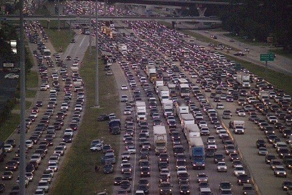
People fleeing Houston, Texas, because of Hurricane Rita.
Photo: Shinoda28107, used under Creative Commons.
Places characterized by greater proportions of disadvantaged populations, housing damage, and to a slightly lesser extent, more densely built environments, were significantly more likely to experience out-migration in the wake of the storms. These results show that social vulnerabilities were at play in shaping migration flows following Hurricanes Katrina and Rita, a finding that dovetails with other vulnerability studies that have brought attention to the link between social inequality and post-disaster migration.4
Our findings suggest that policymakers need to consider social factors that influence vulnerability when responding to disasters. Doing so would allow them to better assess risk, better target disaster mitigation efforts, and better anticipate which areas will face particular obstacles to recovery.
Candice A. Myers is a Ph.D. candidate and Tim Slack is assistant professor, Louisiana State University. Joachim Singelmann is David J. Kriskovich distinguished professor of sociology at Louisiana State University and LSU Agricultural Center.
References
- Wisener et al., At Risk: Natural Hazards, People’s Vulnerability and Disasters (London: Routledge, 1994).
- Lori M. Hunter, “Migration and Environmental Hazards,” Population and Environment 26, no. 4 (2005): 273-302; Alice Fothergill and Lori A. Peek, “Poverty and Disasters in the United States: A Review of Recent Sociological Findings,” Natural Hazards 32, no. 1 (2004): 89-110; Kathleen Tierney, “Social Inequality, Hazards, and Disasters,” in On Risk and Disaster: Lessons From Hurricane Katrina, ed. Ronald J. Daniels, Donald F. Ketti, and Howard Kunreuther (Philadelphia: University of Philadelphia, 2006); Hazel A. Morrow-Jones and Charles A. Morrow-Jones, “Mobility Due to Natural Disaster: Theoretical Considerations and Preliminary Analyses,” Disasters 15, no. 2 (1991): 126-32; and Walter G. Peacock and Chris Girard, “Ethnic and Racial Inequalities in Hurricane Damage and Insurance Settlements,” Hurricane Andrew: Ethnicity, Gender, and the Sociology of Disasters (New York: Routledge, 1997).
- To see a map of the affected counties and a comparison of net migration rates, see the full article by Myers, Slack, and Singelmann.
- John C. Belcher and Frederick L. Bates, “Aftermath of Natural Disasters: Coping Through Residential Mobility,” Disasters 7, no. 2 (1983): 118-27; and Eugene J. Haas, Robert W. Kates, and Martyn J. Bowden, Reconstruction Following Disaster (Cambridge, MA: MIT, 1977).